Findelglacier Campaign (3rd - 6th Oct 2009)
This is the account of a scientific field campaign, which is adventurous enough to be added to this particular blog!
The Findelglacier is situated close to Zermatt in the Swiss Alps and has lately been chosen as one of the glaciers monitored by the World Glacier Monitoring Service (WGMS) (see http://www.wgms.ch/about.html). Traditionally, the mass balance is measured using so-called ablation poles. These are six metres long, vertically embedded in the glacier in nine metre deep holes. The poles are then visited on a regular basis and the amount of mass reduction can be estimated from their length above the surface. Such measurements are time consuming (although fun) and give only sparse sampling.
A new PhD project undertaken by RSLs (Remote Sensing Labs) former MSc student Philip, now with Physical Geography, aims at using LIDAR data for the estimation of the mass balance. Modern LIDAR systems may be calibrated radiometrically and thus produce not only range findings used for the production of surface models but can also provide information about the target on the ground, i.e. its reflectivity. For such calibrations, spectral measurements of ground targets are required and that was the reason why I was lucky enough to join this little expedition.
Day 1
Our first destination of the day was the airfield of Turtmann, which we had identified as suitable ground reference target. We carried our numerous material (GPS, tripod, spectroradiometer plus all our personal gear including full glacier equipment, sleeping bags, matresses and stove) to the airfield and started to acquire spatial positions and spectral data.

Acquiring white reference measurements with the ASD FieldSpec instrument.

Philip giving me a hand for the white reference measurement
We soon had sampled two patches of the airfield and returned back to the train station to take the next train to Zermatt. During this train ride, I had the joy to go over the food plan of the next days; we had been given the responsiblity of buying all the food and I was soon immersed in food calculations. Thus prepared, we entered the supermarket and got all provisions in a minimal amount of time. This was followed by another train ride on the famous Gornergrat Railway, world famous, I expect, at least in Japan, which provides large contingents of tourists to this region. We got out at the 'Rotenboden' station, from where we had a short walk to a little research hut, slightly dilapidated but well supplied with food and cooking ware.

The research cabin overlooking the Gorner glacier with the Monte Rosa region in the background.
Having arrived at the hut, we admired the wild scenery and had a brew before setting to work. The University had acquired new expedition tents from the Swiss outdoor company Exped. I had a lot of Exped gear myself and was dead keen to set up one of the tents for fun and training reasons. I must admit that we did not come close to the four minutes of setup time, but we perfected our setup sequence, which had started suboptimal due to the lack of a user manual.

Dinner preparations in front of the hut (2700 m asl).
Day 2
This was the day of the LIDAR data acquisition and our job consisted of setting up and operating a GPS base station for dGPS post-processing of the data. For that reason, we took the first train up to the top and set up our tripod. To keep off the tourists, a climbing rope was borrowed from the nearby hotel and we rigged up a fence.
The next five hours consisted of sitting around, looking at the scenery, watching tourists, observing the GPS and our fixwinged aircraft flying the LIDAR, not to forget the hearty breakfast at the hotel!
After finishing the GPS data take, it was time for a late lunch, during which we had a discussion with a former mountain guide, who regarded the climate change issue with suspicion. Fair enough, but what is really striking is that the public only gets the media hypes but lacks the facts of scientific evidence ...
Back at the camp, we prepared for another 3 guys who were to join the team this evening. As the hut had limited bunks, we set up a Russian made tent, that had been part of some deal including sleeping bags and down jackets as well. Most curious was the tunnel system at one end, for which we could find no explanation whatsoever.
The rest of the day passed with preparing all gear for the day after, cooking dinner and going through next day's plan again.
Day 3
We got up at six am, had porridge for breakfast and hauled all the gear up to a flat terrain section where the helicopter would pick us up. It was full moon and despite that the scenery was way too kitsch, we had to take a picture or two anyway!
All gear was deposited in neat columns according to group and destination and everyone was putting on their climbing harnesses while waiting in the cold morning air. It had been a while since my last helicopter flight and I was eagerly awaiting the arrival of the chopper. Then, the sound of whirrling blades reached our ears and soon the machine appeared and performed an overflight to check out the terrain.
Watch the overflight and landing as video!
Three of us plus our day packs were soon crammed into the back seat of the helicopter and we were off, our mountain guide was already in one of the front seats. The flight was short but stunning. Flying just a few dozen metres above the glacier with all the crevasses and the lateral morains and mountain flanks on either side was just awesome!
We were dropped off at around 3400 m asl. We ropped up for glacier travel and, guided by our GPS, soon arrived at the first point of interest. The goal was to determine the accumulation of snow since last autumn. Using our snow shovel and ice axes, we began to dig in earnest, taking turns as digging at this altitude gets exhausting.
We had to hack through some ice lenses on the way and eventually reached another hard and dirty layer, which was proclaimed as 'last year's level' by Horst. We then took snow cores that were weighted and an exact profile of the snow column was recorded. During the digging, Philip and I took spectral samples of the snow surface nearby while being belayed by the mountain guide. Soon after, too many clouds moved in and spectral sampling was getting impractical. Still, I had to tramp along with the spectrometer on my back and I'm bound to say that ergonomically speaking, it's a pain in the backside after a few hours.
On the way to our camp site, a few existing ablation poles were visited and measured.
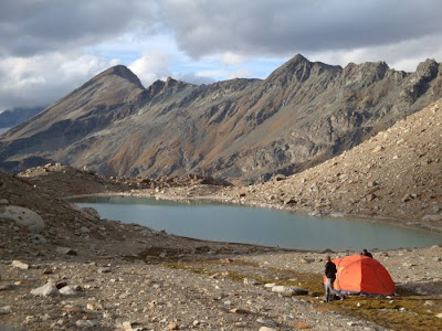
I was already excited about getting to the camp, as it was situated near a little lake at 2900 m asl and had been described as a really neat place. Indeed, there were some flat spots above the tranquile lake and the first thing we did was to take off a layer or two, cause it had gotten somewhat warmer during our descent and put on the kettle for a nice cuppa.
After the first evening, I had gotten the job of chief cook on this expedition. Tonight's dinner for a total of 10 persons (another 3 had hiked in today) was logistically a challenge, involving three different models of outdoor stoves and an assortment of pots and pans. Still, my helpers and I managed to produce soup followed by pasta with tomato sauce and tea.
The tents turned out to be a bit restricted in space with four persons, nevertheless, once the impertinent snoring had stopped (or I had fallen asleep anyway), the night passed fairly well and there was even a bit of rain, which I enjoyed particularly.
Day 4
Wake up call was at 6am again and once more porridge was on the menu. There is something particular about porridge. It somehow lasts a good deal longer than calculated. It is a mystery. In any case, a bit more than half the porridge was gone when everyone stated that they were really, really stuffed. Yeah, right ....
We packed the camp and prepared the transport netting of the helicopter. We gave the spectroradiometer to the cargo specialist to take down into the valley as the weather was too cloudy for measurements today, saying "Watch out for this one, costs about 60'000 bucks!".
Our team had no flight today, but tramped to the ablation poles, carrying along a Heuke. This apparatus is best described as a portable steam boiler with two propane burners providing the heat input. The steam is then lead through a long piping and ends in a lance with vents at the tip. With this device, one can virtually steam holes into ice, up to around 9 metres deep. Into these, new ablation poles are sunk.

En route to our measurement points. The lateral moraine exposed by the fast retreating glacier is clearly visible in light colours.
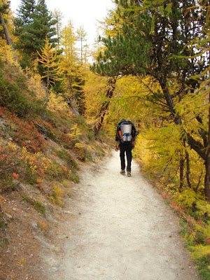
Having drilled and measured all poles we had to do, the long tramp to the train station started. I enjoyed the hike, as it led across some wild landscapes.
A most interesting and enjoyable trip! Looking forward to getting some more measurements out in the hills!
Cheers to the team!
Andy


2 Comments:
Andy,
I'm heading to the Gorner Glacier this summer to look at the moulins. Can you please contact me at gar.davies"at"ntlworld.com as i'd like some advice.
Many thanks
Gareth Davies
Tony,
You dont know me but could you please get in contact with me at welshcavediver"at"gmail.com
I'm heading out to the Gorner Glacier this summer with a Welsh expedition to explore the ice caves and was hoping you could provide some advice.
Thanks
Gareth Davies
Post a Comment
<< Home